India / Jammu & Kashmir/ Ladakh/ Ladakh
Sight Address : Kargil is located 60 km and 204 km, respectively from Drass and Srinagar to the west, 234 km from Leh to the east. Edit
Detail InformationEdit
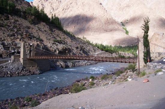
Kargil, the headquarter of Kargil district, is around 204 Kms. to the east of Srinagar and 234 Kms. to the west of Leh. It was a transit point of caravans on their way to and from China, Tibet, Yarken and Kashmir till 1949, but since 1974 with the influx of tourists the region has been replaced as centre for tourism related activities. Tourists traveling between Zangskar, Leh and Srinagar have to make a night halt here, before starting for the second day of their journey. Kargil is located on the bank of the Suru River which flows at around 10,000 ft. high. Here people were followers of Buddhist religion till the 14th century AD. Presently, Kargil is inhabited by Muslims of Shia sect.
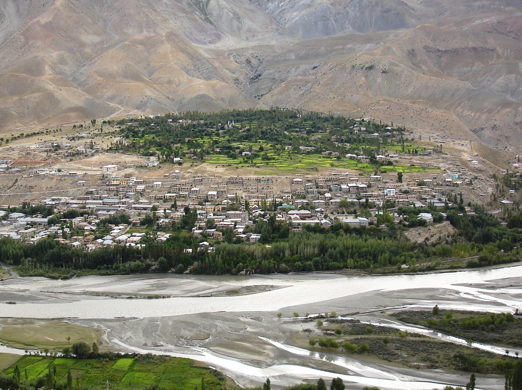
Kargil view from top
HistoryEdit
Kargil, the name is said to be derived from the words Khar and rKil. Khar means castle and rKil means centre thus a place between castles as the place lay between many kingdoms. The competing theory is that Kargil has been derived from the words “Gar” and “Khil”. Gar in local language mean ‘Anywhere’ and Khil means a central place where people could stay. A farmland in Kargil lies straddled below the mountains and above a flowing stream. Kargil remained relatively obscure right until the Partition of India when the issue of Kashmir became the focal point and resulted in the Indo-Pakistani War of 1947. There were pitched battles fought around Kargil which saw the entire area including Drass and Zoji La Pass initially coming under Pakistan control before most of it being reclaimed by Indian troops by November 1948 . It remained with India after the ceasefire. It again saw some action in the Second Kashmir War with India managing to wrest back the reminder of the Kargil area twice. The first capture was on May 17, 1965, when skirmishes broke out in Rann of Kutch, and India retaliated in the Kashmir sector. However, this had to be returned as per UNMOGIP treatise. On August 15, the same year Kargil fell to Indian forces, though it was once again returned as part of the Tashkent Agreement. However in the Indo-Pakistani War of 1971 the entire Kargil region including key posts was captured by Indian troops under leadership of Col. Chewang Rinchen .In order to straighten out the line of control in the area, the Indian Army launched night attacks when the ground temperatures sank to below −17° and about 15 enemy posts located at height of 16,000 feet and more were captured. After Pakistan forces lost the war and agreed to the Shimla Agreement, Kargil and other strategic areas nearby remained with India. Kargil became a separate district in the Ladakh region during the year 1979 when it was bifurcated from the Leh district. The area shot into the spotlight in spring of 1999, when under a covert plan hatched by the then Army Chief Pervez Musharraf, armed infiltrators from Pakistan, aided by the Pakistani army, occupied vacant high posts belonging to India in the Kargil and Drass regions. The result was a limited scale conflict (Kargil War) between both nuclear equipped nations that ended with India regaining the Kargil region through military power and diplomatic pressure.
Must SeeEdit
Popular
Visiting TimeEdit
N.A.
Closed OnEdit
N.A.
Best Season to VisitEdit
June to October.
Best Time To VisitEdit
Morning , Afternoon, Evening.
Time Required for SightseeingEdit
3-4 hours.
Ticket Required : No Edit
Individual National Adult Rs. : N.A.
Kids Rs. : N.A.
Individual Foreigner Adult Rs. : N.A.
Kids Rs. : N.A.
Still Photo Camera Rs. : N.A.
Video Camera Rs. : N.A.
Guide Required : No Edit
Approximate cost: N.A.
Dress Code (If Any) : N.A. Edit
Dress Require: No
Restaurants NearbyAdd / Edit
- Nun Kun Deluxe Camp ; Kargil Leh Highway | 3 km beore Mulbekh, Kargil, India ; Ph/M – N.A. ; Food Serve – N.A.
How to ReachEdit
Taxi : This place is well connected by road.It is located 204 km from Srinagar to the west respectively, 234 km from Leh to the east and is easily accessible by taxis from leh and srinagar at 3-4 hrs.
BUS : This place is well connected by leh .Himachal Tourism and State Transport Corporation along with J&K SRTC and several other travel companies run regular bus service from Leh.it is 234 km from leh it takes more than 3 hrs.
Train : The closest railway station is Jammu, there are regular train services from Delhi and many other cities to Jammu railway station, from Jammu you can take buses or taxi ride to Srinagar and then to Leh. From Leh you can take bus or taxi to kargil. It is located 60 km and 204 km from Drass and Srinagar to the west respectively, 234 km from Leh to the east.If you are for more adventures you can also rent bikes, available on rent in Leh and will cost you anywhere between rupees 600 a day for an Enfield to rupees 300 for others.
Air : Nearest Airport is Leh Airport .The following airlines (Kingfisher, Jet Airways, and Air India) operate regular flights to Leh from Delhi, Jammu and Srinagar. The duration of Delhi-Leh flight is just an hour long. Better booked the air-tickets before 2 or 3 months in advance because during May to October tickets prices are very high due to heavy tourist influx. From Leh you can take bus or taxi to Kargil from Leh. If you are for more adventures you can also rent bikes, available on rent in Leh and will cost you anywhere between rupees 600 a day for an Enfield to rupees 300 for others.
Others : Truck : Trucks often stop for hitchhikers, who are usually expected to pay half the bus fare, bargaining may be necessary. They are slower than the buses and sometimes stop for long periods to unload cargo.
Things to CarryEdit
- Carry woolan cloths, Camera etc.
Safety / WarningEdit
- Ladakh is one of the safest parts of India, and the most basic precautions are enough to keep you and your possessions safe. Most of the region is dotted with military cantonments every 50-80 kms, but mainly because of its strategic position on international border between India and China. The army plays major part in rescue and aid efforts and that is why you will require to produce identification documents or written permission from local authorities before entering some remote places.
HelplineEdit
- Police Control Room : 100
- Fire Station : 101
- Ambulance : 102/108