India /Kerala /Wayanad /Wayanad
Sight Address : Chembra peak is situated near Meppady town and it is about 17 km from Kalpetta. Edit
Detail InformationEdit
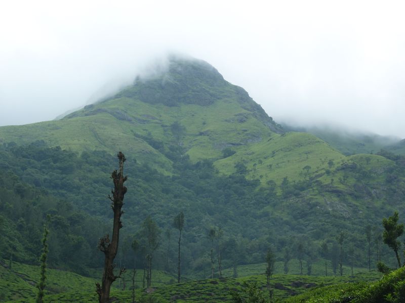
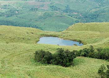
Chembra Peak is the highest peak in Wayanad, at 2,100 metres (6,900 ft) above sea level. Chembra is located near the town of Meppady and is 8 km south of Kalpetta. It is part of the Wayanad hill ranges in Western Ghats, adjoining the Nilgiri Hills in Tamilnadu and Vellarimala in Kozhikode district in Kerala. Chembra Peak is accessible by foot from Meppady. District Tourism Promotion Council provides guides and trekking equipment on hire charges to tourists. Permission from the forest office in Meppady is required for trekking up to Chembra Peak. A heart shaped lake on the way to the top of the peak is a major tourist Arrraction. The lake is believed to have never dried up. You can find the lake halfway to the peak, after getting to the lake you need to trek another halfway, which is through the dense trees of about one to two km. A 5 km journey from Meppadi town through tea estates to Erumakkolli.
HistoryEdit
Chembra Peak is said that during the British era, British planters came here to play golf in the evenings and they constructed a stable for their horses and a rest house in the area. The relics of the rest house can be seen here even now.
Must SeeEdit
Popular
Visiting TimeEdit
N.A.
Closed OnEdit
N.A.
Best Season to VisitEdit
October to May.
Best Time To VisitEdit
Morning , Afternoon.
Time Required for SightseeingEdit
1 to 2 hours.
Ticket Required : No Edit
Individual National Adult Rs. : N.A.
Kids Rs. : N.A.
Individual Foreigner Adult Rs. : N.A.
Kids Rs. : N.A.
Still Photo Camera Rs. : N.A.
Video Camera Rs. : N.A.
Guide Required : Yes Edit
Approximate cost: N.A.
Dress Code (If Any) : No Edit
Dress Require: No
Restaurants NearbyAdd / Edit
- Green Gates Hotel – Wayanad ; T.B. Road, Kalpetta Wayanad – 673 122, Kerala, India ; Ph/M – Phone: 04936 – 202001/2/3/4 Fax: 04936 – 203975 Cell: 0 94476 40559 ; Food Serve – N.A.
How to ReachEdit
Taxi : Taxis and private vehicles are one of the most common means of travel to Wayanad. The most popular route is Bangalore – Mysore – Gundulpet – Munthanga – Sulthan Battery. The roads are in excellent condition.
BUS : KSRTC (both Kerala & Karnataka) and a lot of private companies operate overnight deluxe buses between Kozhikode (aka Calicut) and Bengaluru. People taking buses can get down at Kalpetta and catch another bus to Meppadi. Meppadi is 11 km from Chundale, in the SH29, connecting Chundale to Ooty.
Train : The Nearest railway station from Wayanad is at Calicut, at a distance of around 110 kilometers from this place. It is well connected by a good network of railways. There are a number of local as well as inter-state trains that halt at the Calicut station and connect it with the other major cities of India
Air : The Nearest airport from Wayanad is the Karipur airport of Kozhikode. It is situated at a distance of around 100 kilometers from the city. There are regular flights from the airport to other states in India, like Chennai, Mumbai, Delhi, and Goa and even international destinations
Others : There are plenty of autorickshaws are available for trips around the wayand district.
Things to CarryEdit
- Plenty of water and camera.
Safety / WarningEdit
- One can reach the forest office, from where a pass has to be acquired to trek the mountain.
HelplineEdit
- Police Control Room, Kollam : 100 / 04936-205808
- Kalpetta Fire Station : 101/ 0498-2502901
- Kollam Women Helpline : 1091/0474 2764579
- Fathima matha mission hospital, Wayanad : 04936-202413 (108 for ambulance)
