Author Archives: tourmet.

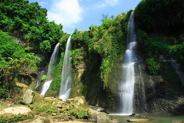
Shuvolong Waterfalls

Bangladesh /Chittagong Division /Rangamati District /Shuvolong

Shuvolong a place in Borokol sub district, situated about 25kilometers (11kilometers – as the crow flies) away from Rangamati. Edit

Detail InformationEdit

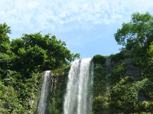
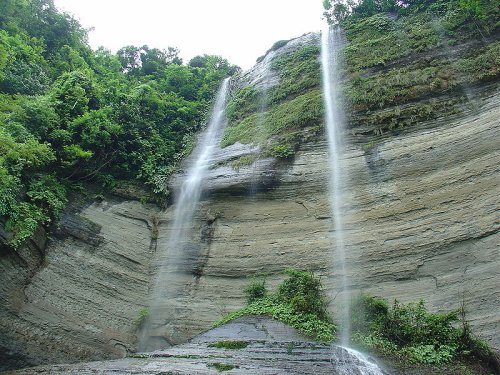
Shuvolong Waterfalls is a good-looking waterfall in Rangamati. It is the attractive place of Rangamati. The only obtainable path to influence at the waterfall is through water, through the lake. People visit there by boat. It is a well-known place with the tourists for the waterfall, high hills and the natural neighbouring it offers. This waterfall is just in advance the Shubholong Bazaar. Means from the waterfall, it will take from one place to another 5 minutes to reach at bazaar. So that Shuvolong is with no trouble easy to get to by speed boat or motor boats from Rangamati.

Shuvolong-Waterfalls, Rangamati

Shuvolong-Waterfalls, Rangamati

HistoryEdit

N.A.

Must SeeEdit

Popular

Visiting TimeEdit

N.A.

Closed OnEdit

N.A.

Best Season to VisitEdit

October to March.

Best Time To VisitEdit

Morning, Afternoon, Evening.

Time Required for SightseeingEdit

1 to 2 hours.

Ticket Required : No Edit

Individual National Adult Rs. : N.A.

Kids Rs. : N.A.

Individual Foreigner Adult Rs. : N.A.

Kids Rs. : N.A.

Still Photo Camera Rs. : N.A.

Video Camera Rs. : N.A.

Guide Required : No Edit

Approximate cost: N.A.

Dress Code (If Any) : No Edit

Dress Require: N.A.

Restaurants NearbyAdd / Edit

How to ReachEdit

Taxi : N.A.

Bus : Rangamati by bus from Chittagong there is one direct bus Paharica starts from Chittagong at 8:00 AM to 8:00 PM and from Rangamati at 8:00 AM to 8:50 PM in every one hour interval and takes around 2.5 hours. The Paharica Bus fare is 120tk (As of Apr 2014) and you can get the tickets from Muradpur, Oxygen Mor. There are lots of Local Bus towards Rangamati from the same Oxegen but those buses stops at any point where there is passenger which overloads the bus all-times and takes 3 hours journey. There are a few direct buses from the capital Dhaka. These buses are not airconditioned. There are some local buses from the nearby districts.

Train : N.A.

Air : Nearest Airport is Shah Amanat International Airport (ICAO: CGP) is serves as Chittagong’s international airport situated at Potenga Road, South Patenga, Chittagong, besides domestic services to and from Dhaka. It is 94.2 km from Rangamati. After reaching at airport buses and rickshaws are available to reach the destination.

Others : Three wheeler taxis (Green CNGs) : You can either reserve the taxi or travel based on shared basis. You can always find taxis on your destination and fare is 30tk to 100tk based on distance if you reserve it. On a shared taxi the fare is 12 tk to 30 tk based on distance.

Things to CarryEdit

  • Carry Camera & Plenty of Water.

Safety / WarningEdit

  • Foreign tourists are required to register while entering Rangamati.
  • Before purchasing any product confirm price from local.

HelplineEdit

  • Police – 999
  • Fire / Ambulance – 199

Gallery


View All Sight of Rangamati … Click Here

Parjatan Hanging Bridge
Shuvolong Waterfalls
Kaptai Lake

Parjatan Hanging Bridge, Rangamati

Bangladesh /Chittagong Division /Rangamati District /Rangamati Sadar

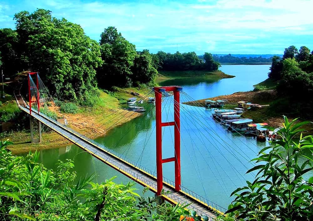
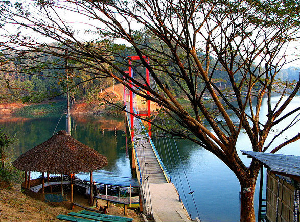
Parjatan Hanging Bridge is located near Deer Park, Rangamati Sadar, Rangamati, Bangladesh. Edit

Detail InformationEdit

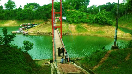
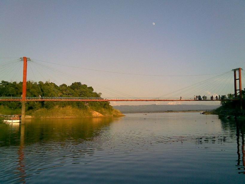
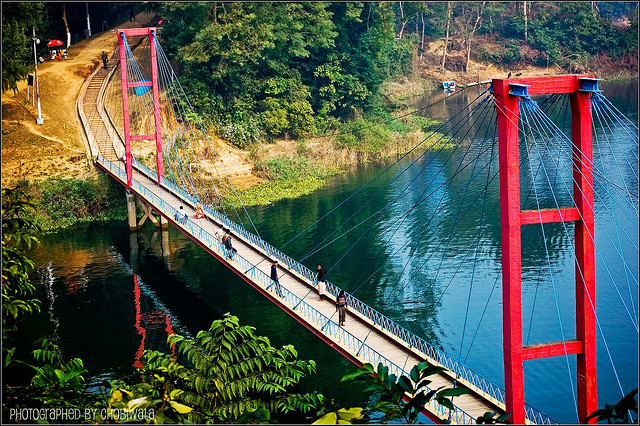
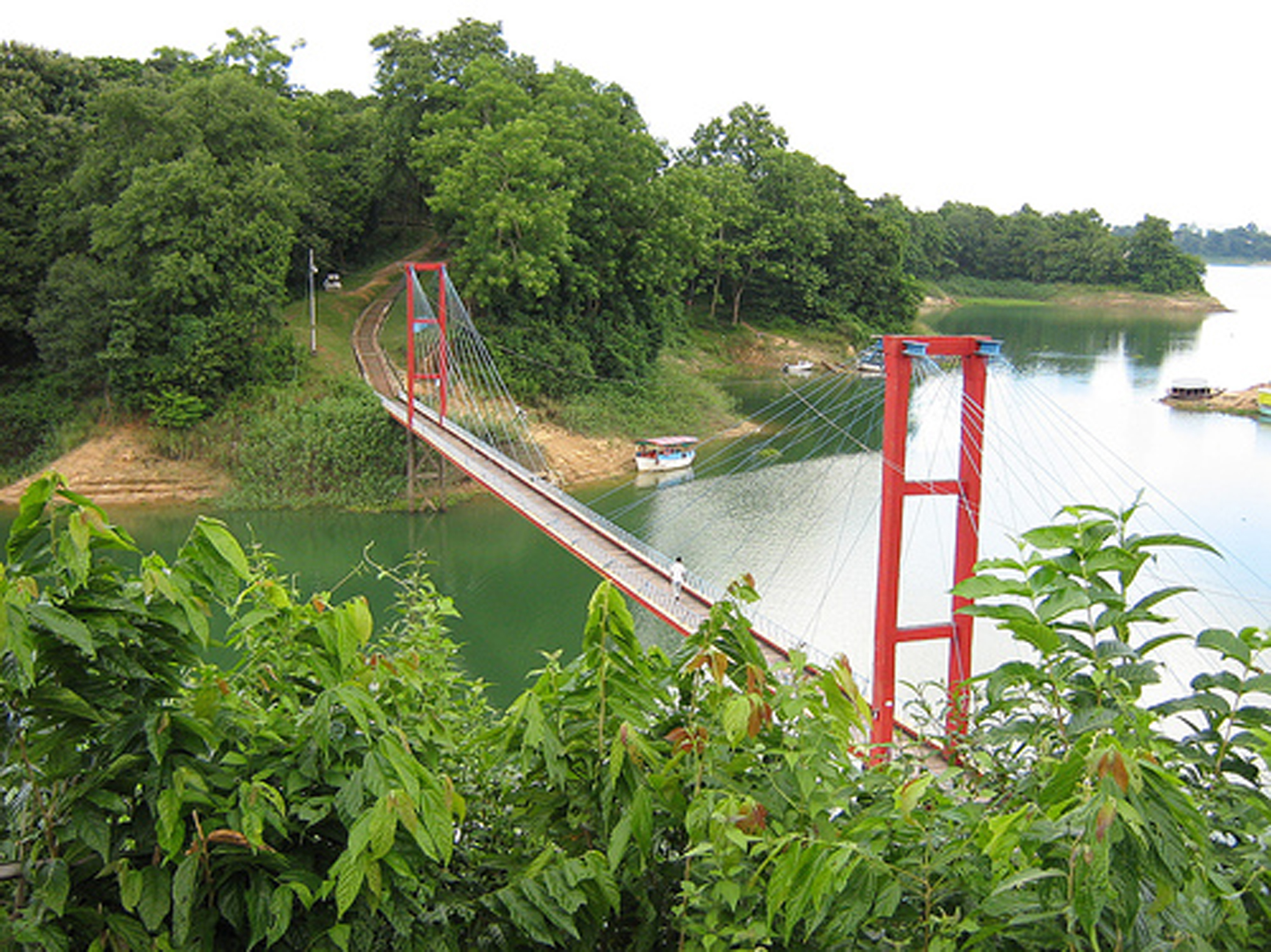
Parjatan Hanging Bridge (Jhulonto Bridge in Bengali) is the landmark icon of Rangamati. It’s a popular tourist spot and a must go destination. This is the only place to visit through out the year. Rangamati expresses her full beauty in rainy season. Trees becoming greener, waterfalls are in full tide, the river Karnaphuli in her full wave in this season. If you already visited Rangamati in winter, we advice to go there again in monsoon; you will feel the difference of nature yourself. If you don’t visit Rangamati you will not discover a big portion of natural beauties of Bangladesh. From Chittagong a 77 km. road amidst green fields and winding hills will take you to Rangamati. It is also connected by waterway from Kaptai. Parjatan holiday complex is the best place to stay in Rangamati. There are other hotels in Rangamati where you can stay. Boating is the prime attraction in Rangamati.

Parjatan Hanging Bridge, Rangamati

Parjatan Hanging Bridge, Rangamati

HistoryEdit

N.A.

Must SeeEdit

Popular

Visiting TimeEdit

N.A.

Closed OnEdit

N.A.

Best Season to VisitEdit

October to March.

Best Time To VisitEdit

Morning, Afternoon, Evening.

Time Required for SightseeingEdit

Minimum 30 minutes.

Ticket Required : No Edit

Individual National Adult Rs. : N.A.

Kids Rs. : N.A.

Individual Foreigner Adult Rs. : N.A.

Kids Rs. : N.A.

Still Photo Camera Rs. : N.A.

Video Camera Rs. : N.A.

Guide Required : No Edit

Approximate cost: N.A.

Dress Code (If Any) : No Edit

Dress Require: N.A.

Restaurants NearbyAdd / Edit

  • Peda Ting Ting Restaurant ;  Kaptai Lake, (Hire/ Take a Boat From Reserve Bazar and Peda Ting Is the First Stopage) Towards Shuvolong, Rangamati, Bangladesh. ; Ph/M –  035162052; Food Serve –  N.A.

How to ReachEdit

Taxi : N.A.

Bus : Rangamati by bus from Chittagong there is one direct bus Paharica starts from Chittagong at 8:00 AM to 8:00 PM and from Rangamati at 8:00 AM to 8:50 PM in every one hour interval and takes around 2.5 hours. The Paharica Bus fare is 120tk (As of Apr 2014) and you can get the tickets from Muradpur, Oxygen Mor. There are lots of Local Bus towards Rangamati from the same Oxegen but those buses stops at any point where there is passenger which overloads the bus all-times and takes 3 hours journey. There are a few direct buses from the capital Dhaka. These buses are not airconditioned. There are some local buses from the nearby districts.

Train : N.A.

Air : Nearest Airport is Shah Amanat International Airport (ICAO: CGP) is serves as Chittagong’s international airport situated at Potenga Road, South Patenga, Chittagong, besides domestic services to and from Dhaka. It is 94.2 km from Rangamati. After reaching at airport buses and rickshaws are available to reach the destination.

Others : Three wheeler taxis (Green CNGs) : You can either reserve the taxi or travel based on shared basis. You can always find taxis on your destination and fare is 30tk to 100tk based on distance if you reserve it. On a shared taxi the fare is 12 tk to 30 tk based on distance.

Things to CarryEdit

  • Carry Camera & Plenty of Water.

Safety / WarningEdit

  • Foreign tourists are required to register while entering Rangamati.
  • Before purchasing any product confirm price from local.

HelplineEdit

  • Police – 999
  • Fire / Ambulance – 199
Gallery


View All Sight of Rangamati … Click Here

Parjatan Hanging Bridge
Shuvolong Waterfalls
Kaptai Lake

Paharpur Museum

Bangladesh /Rajshahi Division /Naogaon District /Paharpur

Paharpur Museum, Paharpur , Bangladesh. Edit

Detail InformationEdit

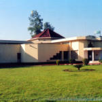
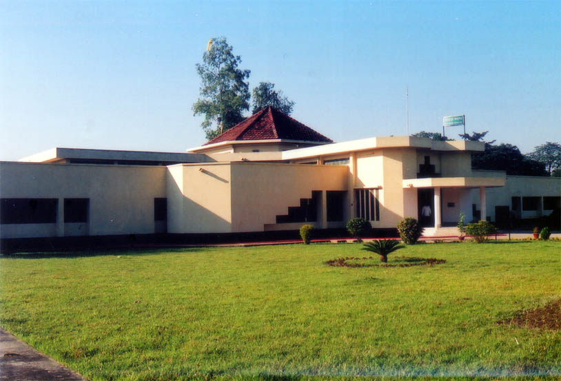
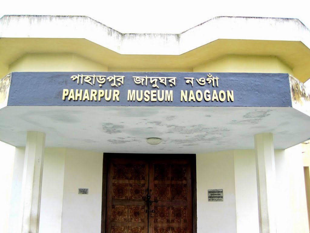
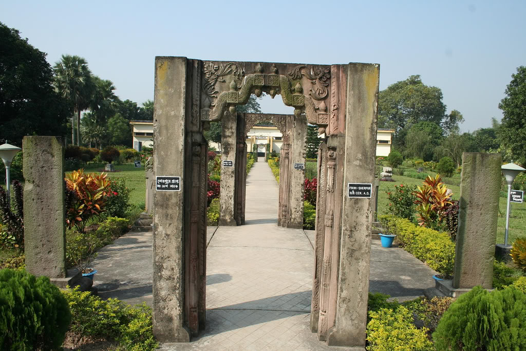
The small museum gives a good idea of the range of cultures that have used this site. Stucco Buddha heads unearthed here are similar to the Gandhara style of Indo-Hellenic sculpture from what is now northwestern Pakistan. Sculptural work includes sandstone and basalt sculptures, but the stonework of Hevagara in passionate embrace with Shakti is the collection’s finest item. The most important find, a large bronze Buddha, is usually away wooing fans on a seemingly endless world tour.

Paharpur Museum, Paharpur

Paharpur Museum, Paharpur

HistoryEdit

N.A.

Must SeeEdit

Attraction

Visiting TimeEdit

April – September
10 am – 6 pm (Tue-Sat)
2.30 pm – 6 pm (Mon)
October to March
9 am – 5 pm (Tue-Sat)
2.30 pm – 5 pm (Mon)

Closed OnEdit

N.A.

Best Season to VisitEdit

October to March.

Best Time To VisitEdit

Morning, Afternoon, Evening.

Time Required for SightseeingEdit

1 to 2 hours.

Ticket Required : Yes Edit

Individual National Adult Rs. : Tk 100

Kids Rs. : N.A.

Individual Foreigner Adult Rs. : N.A.

Kids Rs. : N.A.

Still Photo Camera Rs. : N.A.

Video Camera Rs. : N.A.

Guide Required : No Edit

Approximate cost: N.A.

Dress Code (If Any) : No Edit

Dress Require: N.A.

Restaurants NearbyAdd / Edit

How to ReachEdit

Taxi : N.A.

Bus : The ruins at Paharpur are situated just off the Naogaon-Jaipurhat Road. There are regular buses from Jaipurhat between 7am and 4pm to Paharpur for Tk 10. The journey is 9km, taking about 25 minutes.

Train : Catch a train to Jamalganj Railway Station, located only 4.5km down the road (about 10 minutes). A rickshaw can be waved down for the short trip from the station to the Paharpur ruins.

Air : Nearest Airport to Paharpur is Zia International Airport (DAC) is an airport in the region of Dhaka in the country of Bangladesh. It is 126.8 km from Paharpur. After landing at Airport take bus to reach Paharpur.

Others : Buses can be used to get between major towns, or else rickshaws for small distances.

Things to CarryEdit

  • Carry Camera & Plenty of Water.

Safety / WarningEdit

  • Before purchasing any product confirm price from local.

HelplineEdit

  • Police – 999
  • Fire / Ambulance – 199
Gallery

View All Sight of Paharpur … Click Here

Ruins of the Buddhist Vihara, Paharpur

Somapura Mahavira, Paharpur

Paharpur Museum, Paharpur

Somapura Mahavira

Bangladesh /Rajshahi Division /Naogaon District /Paharpur

Somapura Mahavira is situated at Paharpur Bihar Museum, Naogaon, Bangladesh. Edit

Detail InformationEdit

Somapura Mahavira (sometimes called Paharpur Vihara) in Bangladesh is one of the world’s grandest and most important historic Buddhist monasteries. Built under the remit of the Pala Emperor Dharmapala in the seventh century, the name Somapura Mahavira – meaning the Great Monastery – hints at its vast size. Somapura Mahavira continued to thrive as an academic and religious hub until the twelfth century and today it is considered to be one of the best examples of the artistic excellence of its time. In fact, Somapura Mahavira is listed as a UNESCO World Heritage site, in great part for influencing future Buddhist architecture around the world. The site is now open to the public and there is a small museum exhibiting local finds.

Somapura Mahavira, Paharpur

Somapura Mahavira, Paharpur

HistoryEdit

Somapura Mahavira in Sanskrit Called Great Monastery 8th-century Buddhist monastery in the village of Paharpur, near Rajshahi, northwestern Bangladesh. Covering almost 27 acres (11 hectares) of land, it is one of the largest monasteries south of the Himalayas. Through the 17th century it was an important intellectual centre that was occupied alternately by Buddhists, Jainas, and Hindus. Clues to its various inhabitants are found on artwork contained within the Somapura Mahavira’s thick outer walls.

Must SeeEdit

Attraction

Visiting TimeEdit

10:00 am – 5:00 pm

Closed OnEdit

N.A.

Best Season to VisitEdit

October to March.

Best Time To VisitEdit

Morning, Afternoon, Evening.

Time Required for SightseeingEdit

1 to 2 hours.

Ticket Required : No Edit

Individual National Adult Rs. : N.A.

Kids Rs. : N.A.

Individual Foreigner Adult Rs. : N.A.

Kids Rs. : N.A.

Still Photo Camera Rs. : N.A.

Video Camera Rs. : N.A.

Guide Required : No Edit

Approximate cost: N.A.

Dress Code (If Any) : No Edit

Dress Require: N.A.

Restaurants NearbyAdd / Edit

How to ReachEdit

Taxi : N.A.

Bus : The ruins at Paharpur are situated just off the Naogaon-Jaipurhat Road. There are regular buses from Jaipurhat between 7am and 4pm to Paharpur for Tk 10. The journey is 9km, taking about 25 minutes.

Train : Catch a train to Jamalganj Railway Station, located only 4.5km down the road (about 10 minutes). A rickshaw can be waved down for the short trip from the station to the Paharpur ruins.

Air : Nearest Airport to Paharpur is Zia International Airport (DAC) is an airport in the region of Dhaka in the country of Bangladesh. It is 126.8 km from Paharpur. After landing at Airport take bus to reach Paharpur.

Others : Buses can be used to get between major towns, or else rickshaws for small distances.

Things to CarryEdit

  • Carry Camera & Plenty of Water.

Safety / WarningEdit

  • Before purchasing any product confirm price from local.

HelplineEdit

  • Somapura Mahavira : +880 2-8126817 Police – 999
  • Fire / Ambulance – 199
Gallery

View All Sight of Paharpur … Click Here

Ruins of the Buddhist Vihara, Paharpur

Somapura Mahavira, Paharpur

Paharpur Museum, Paharpur

Ruins of the Buddhist Vihara, Paharpur

Bangladesh /Rajshahi Division /Naogaon District /Paharpur

Ruins of the Buddhist Vihara is located in Paharpur. Paharpur is a small village 5 km west of Jamalganj in the Greater Rajshahi District, in the northwest of Bangladesh. Edit

Detail InformationEdit

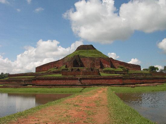
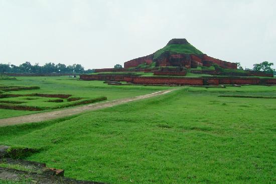
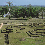
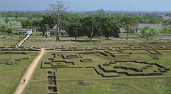
Ruins of the Buddhist Vihara at Paharpur is said to be the second largest single Buddhist monastery south of the Himalayas. The heart-land of ancient “Varendra”, close to the village of Paharpur the extensive ruins of the Buddhist monastic complex are the most spectacular and important pre-Islamic monument in Bangladesh. Evidence of the rise of Mahayana Buddhism in Bengal from the 7th century onwards, Somapura Mahavira, or the Great Monastery, was a renowned intellectual centre until the 12th century. Its layout perfectly adapted to its religious function, this monastery-city represents a unique artistic achievement. With its simple, harmonious lines and its profusion of carved decoration, it influenced Buddhist architecture as far away as Cambodia.

Ruins of the Buddhist Vihara, Paharpur

Ruins of the Buddhist Vihara, Paharpur

HistoryEdit

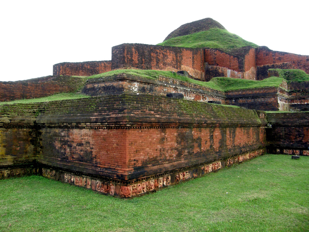
The Ruins of the Buddhist Vihara at Paharpur contain a Buddhist Monastery dating from the late 8th century. It was made a WHS as a tribute to the Pala dynasty, that ruled Bengal and Bihar for 3,5 centuries from the middle of the 8th century. The monastery is built as a quadrangle, measuring 281 meter on each side. All outer four wings contain monastic cells, 177 in total. In the center of the vast open courtyard of the monastery stands the shrine. Its remains are still 21 meter high and have three gradually diminishing terraces. The walls were built of burnt bricks, some ornamented with motifd of flowers and seated Buddhas. There were also bands of terracotta plaques in rows all around the terraces.

Must SeeEdit

Popular

Visiting TimeEdit

N.A.

Closed OnEdit

N.A.

Best Season to VisitEdit

October to March.

Best Time To VisitEdit

Morning, Afternoon, Evening.

Time Required for SightseeingEdit

1 to 2 hours.

Ticket Required : No Edit

Individual National Adult Rs. : N.A.

Kids Rs. : N.A.

Individual Foreigner Adult Rs. : N.A.

Kids Rs. : N.A.

Still Photo Camera Rs. : N.A.

Video Camera Rs. : N.A.

Guide Required : No Edit

Approximate cost: N.A.

Dress Code (If Any) : No Edit

Dress Require: N.A.

Restaurants NearbyAdd / Edit

How to ReachEdit

Taxi : N.A.

Bus : The ruins at Paharpur are situated just off the Naogaon-Jaipurhat Road. There are regular buses from Jaipurhat between 7am and 4pm to Paharpur for Tk 10. The journey is 9km, taking about 25 minutes.

Train : Catch a train to Jamalganj Railway Station, located only 4.5km down the road (about 10 minutes). A rickshaw can be waved down for the short trip from the station to the Paharpur ruins.

Air : Nearest Airport to Paharpur is Zia International Airport (DAC) is an airport in the region of Dhaka in the country of Bangladesh. It is 126.8 km from Paharpur. After landing at Airport take bus to reach Paharpur.

Others : Buses can be used to get between major towns, or else rickshaws for small distances.

Things to CarryEdit

  • Carry Camera & Plenty of Water.

Safety / WarningEdit

  • Before purchasing any product confirm price from local.

HelplineEdit

  • Police – 999
  • Fire / Ambulance – 199

Gallery


View All Sight of Paharpur … Click Here

Ruins of the Buddhist Vihara, Paharpur
Somapura Mahavira, Paharpur
Paharpur Museum, Paharpur

Tomb of Khan Jahan Ali

Bangladesh /Khulna Division /Bagerhat District /Bagerhat

Tomb of Khan Jahan Ali, Bagerhat, Bangladesh. Edit

Detail InformationEdit

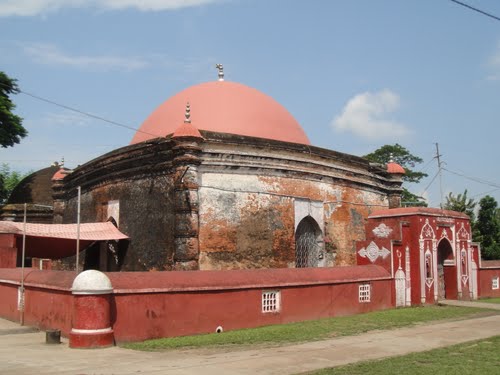
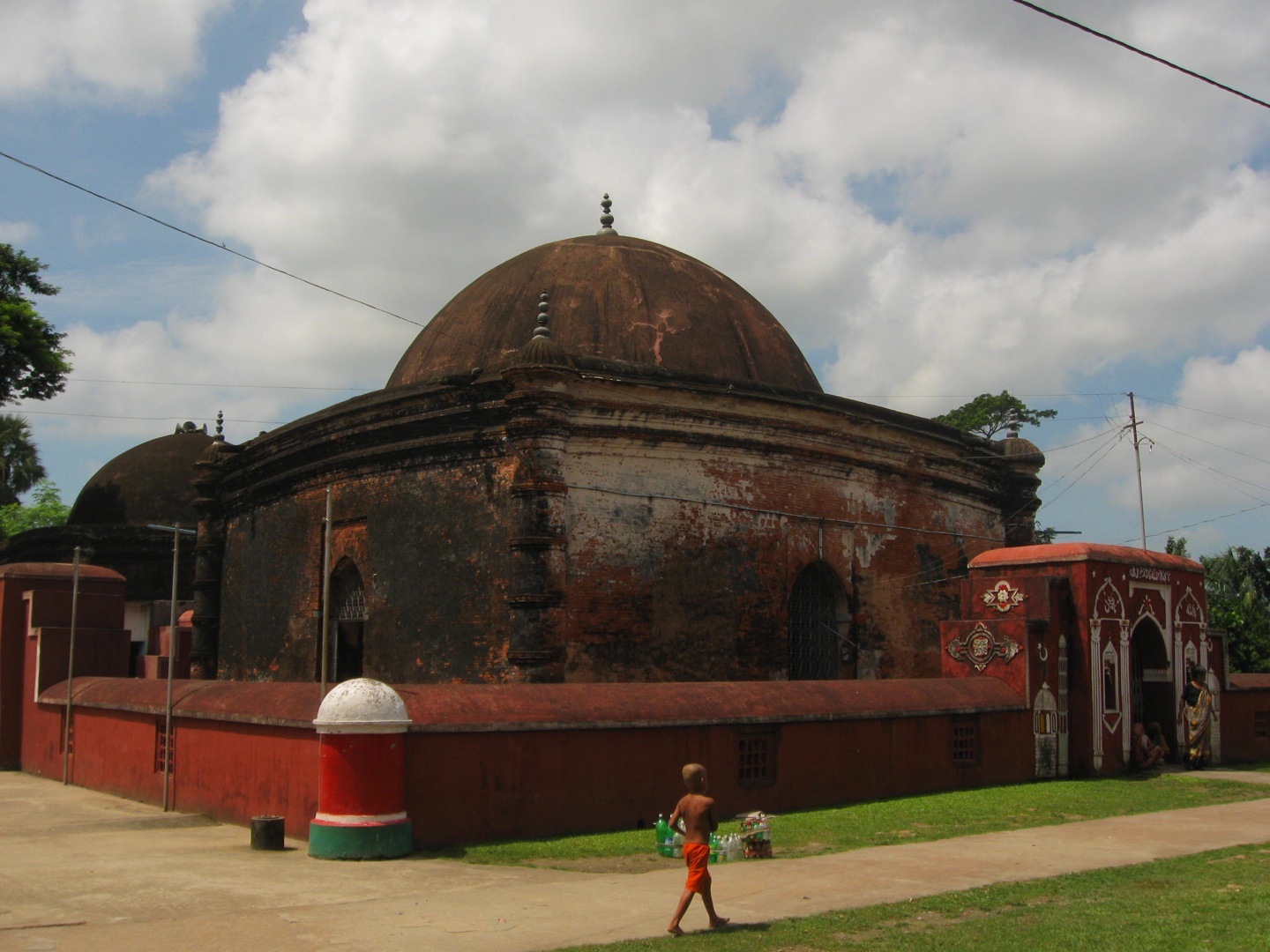
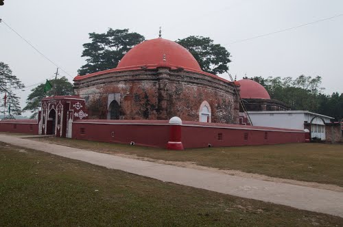
Khan Jahan’s Tomb is the only monument in Bagerhat that retains its original cupolas (domed ceilings). The cenotaph at the entrance is covered with tiles of various colours and inscribed with Quranic verses, but it is usually covered with a red cloth embroidered with gold threads. The single-domed Dargah Mosque is enclosed within the same complex by a massive wall with short towers at each corner and archways on the front and back. This is a popular pilgrimage site and therefore has a little more colour and flair than some of the other monuments around here. The pond, known as Thakur Dighi, which the complex overlooks, contains a large crocodile said to be over 100 years old, which has become a bit of a tourist attraction. There used to be two, but one died in 2011.

Tomb of Khan Jahan Ali, Bagerhat

Tomb of Khan Jahan Ali, Bagerhat

HistoryEdit

Must SeeEdit

Attraction

Visiting TimeEdit

N.A.

Closed OnEdit

N.A.

Best Season to VisitEdit

October to March.

Best Time To VisitEdit

Morning, Afternoon, Evening.

Time Required for SightseeingEdit

1 to 2 hours.

Ticket Required : No Edit

Individual National Adult Rs. : N.A.

Kids Rs. : N.A.

Individual Foreigner Adult Rs. : N.A.

Kids Rs. : N.A.

Still Photo Camera Rs. : N.A.

Video Camera Rs. : N.A.

Guide Required : No Edit

Approximate cost: N.A.

Dress Code (If Any) : No Edit

Dress Require: N.A.

Restaurants NearbyAdd / Edit

How to ReachEdit

Taxi : N.A.

Bus : The best way to go to Bagerhat from Dhaka is to take a bus which takes seven to eight hours. Local buses run from Khulna regularly (Tk 30, 45 minutes). It’s also connected to Mongla with only slightly more effort.

Train : Bagerhat is the terminus of a branch railway from Khulna on the broad gauge system of Bangladesh Railways. After reaching at railway station take a bus to the city.

Air : Nearest Airport is Jessore Airport (IATA: JSR, ICAO: VGJR) is an domestic airport in Jessore, Bangladesh. It is 113 km from Bagerhat . After reaching at airport take a bus to the city.

Others : Cycle-rickshaw from the bus stand is availavle to local Sightseeing.

Things to CarryEdit

  • Carry Camera & Plenty of Water.

Safety / WarningEdit

  • Before purchasing any product confirm price from local.

HelplineEdit

  • Police – 999
  • Fire / Ambulance – 199

Gallery


View All Sight of Bagerhat … Click Here

Sundarban
Shait-Gumbad Mosque
Tomb of Khan Jahan Ali

Shait-Gumbad Mosque

Bangladesh /Khulna Division /Bagerhat District /Bagerhat

Shait-Gumbad Mosque is located in Bagerhat district in southern Bangladesh which is in the division of Khulna. It is about 3 miles far from the main town of Bagerhat. Edit

Detail InformationEdit

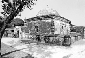
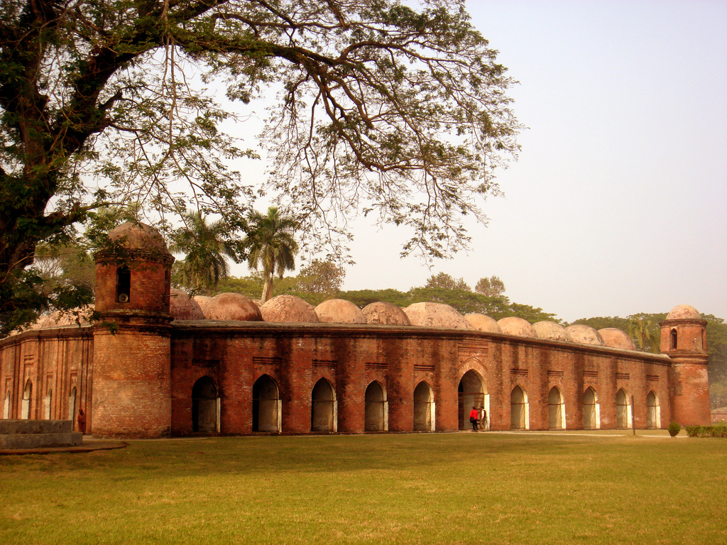
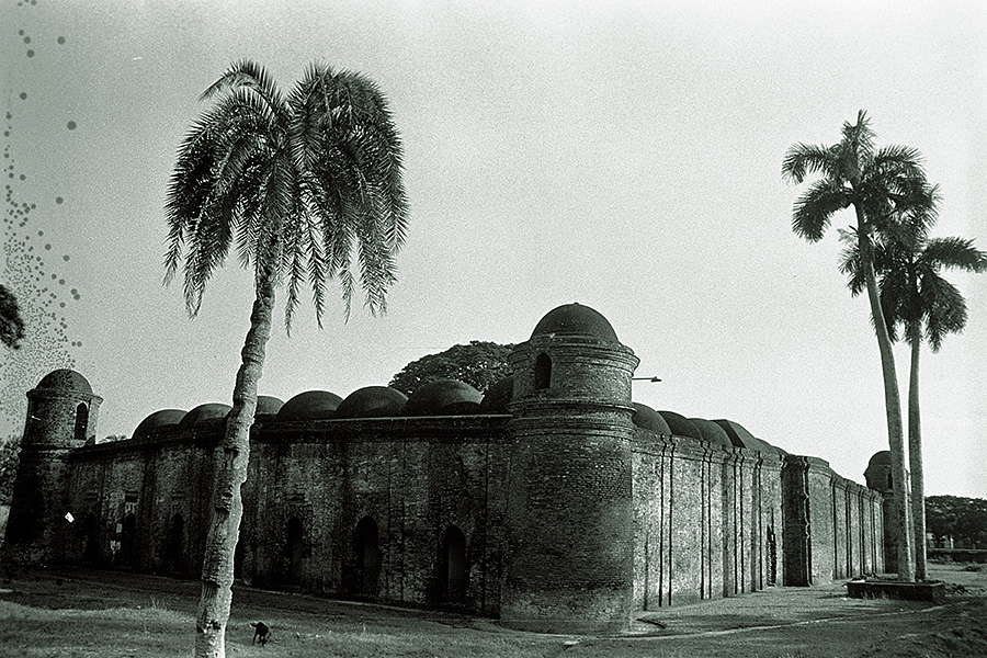
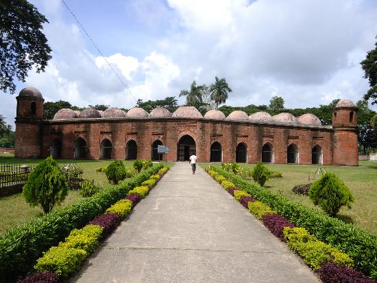
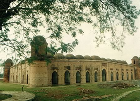
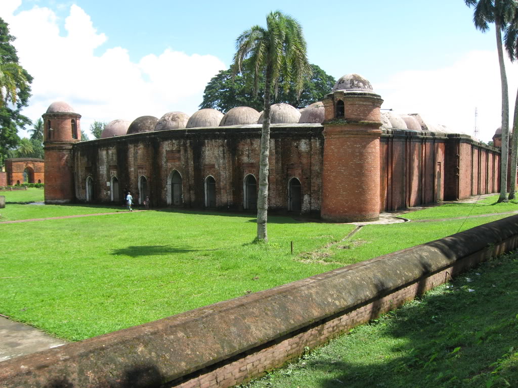
Shaitgumbad mosque, or 60-domed mosque, is located about three miles west of the present Bagerhat town. There are four massive circular towers located at the four corners of the mosque. The towers are slightly tapered towards the top, with a chamber above the roof level. The upper chamber of the two west towers has four windows, while the east towers has two windows. The height of the chamber of the east towers is also smaller than the west towers. Both the west towers have circular stairways reaching the top; which have recently been closed by brick filings. The interior of the mosque has sixty pillars – ten rows of six pillars in each row. All the pillars have been covered during the renovation of the mosque. Only one pillar that has been left uncovered shows a black stone construction. Earlier British records tell us that the pillars were constructed using two or three carved black stones tightly joined together by a system of plug-holes and iron-craps, or with slabs of black stones.

Shait Gumbad Mosque, Bagerhat

Shait Gumbad Mosque, Bagerhat

HistoryEdit

The mosque was built by Khan Jahan Ali, a muslim sufi saint around 1450 A.D. The mosque, built mainly of bricks, measures 192 feet from north to south and 130 feet from east to west. The mosque has an architectural style that strongly resembles other pre-mughal mosques of Bengal.

Must SeeEdit

Popular

Visiting TimeEdit

N.A.

Closed OnEdit

N.A.

Best Season to VisitEdit

October to March.

Best Time To VisitEdit

Morning, Afternoon, Evening.

Time Required for SightseeingEdit

1 to 2 hours.

Ticket Required : No Edit

Individual National Adult Rs. : N.A.

Kids Rs. : N.A.

Individual Foreigner Adult Rs. : N.A.

Kids Rs. : N.A.

Still Photo Camera Rs. : N.A.

Video Camera Rs. : N.A.

Guide Required : No Edit

Approximate cost: N.A.

Dress Code (If Any) : No Edit

Dress Require: N.A.

Restaurants NearbyAdd / Edit

How to ReachEdit

Taxi : N.A.

Bus : The best way to go to Bagerhat from Dhaka is to take a bus which takes seven to eight hours. Local buses run from Khulna regularly (Tk 30, 45 minutes). It’s also connected to Mongla with only slightly more effort.

Train : Bagerhat is the terminus of a branch railway from Khulna on the broad gauge system of Bangladesh Railways. After reaching at railway station take a bus to the city.

Air : Nearest Airport is Jessore Airport (IATA: JSR, ICAO: VGJR) is an domestic airport in Jessore, Bangladesh. It is 113 km from Bagerhat . After reaching at airport take a bus to the city.

Others : Cycle-rickshaw from the bus stand to the Shait Gumbad Mosque should run around Tk 10.

Things to CarryEdit

  • Carry Camera & Plenty of Water.

Safety / WarningEdit

  • Before purchasing any product confirm price from local.

HelplineEdit

  • Police – 999
  • Fire / Ambulance – 199

Gallery


View All Sight of Bagerhat … Click Here

Sundarban
Shait-Gumbad Mosque
Tomb of Khan Jahan Ali

Sundarban

Bangladesh /Khulna Division /Bagerhat District /Bagerhat

Sundarban is located at Satkhira, 743439, Bangladesh. Edit

Detail InformationEdit

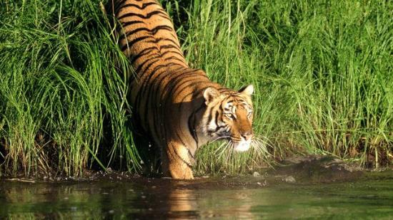
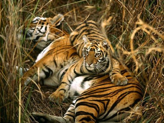
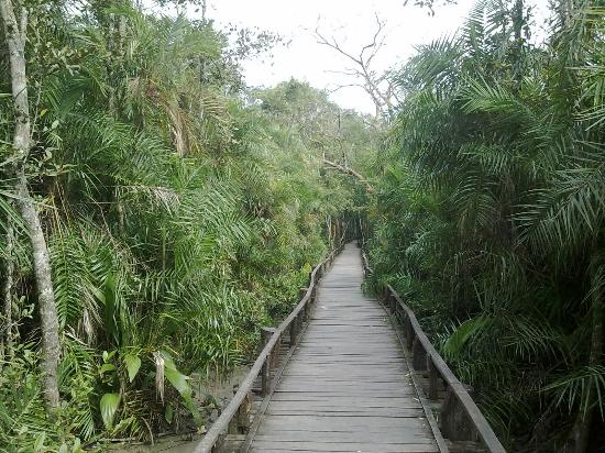
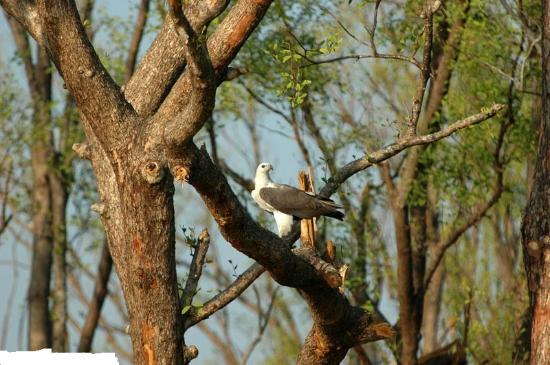
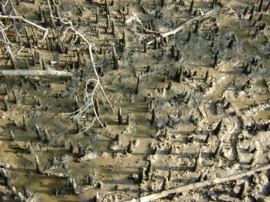
Sundarban is the largest single block of tidal halophytic mangrove forest in the world. The name Sundarban can be literally translated as “beautiful jungle” or “beautiful forest” in the Bengali language (Sundar, “beautiful” and ban, “forest” or “jungle”). The name may have been derived from the Sundari trees that are found in Sundarbans in large numbers. Alternatively, it has been proposed that the name is a corruption of Samudraban or Chandra-bandhe (name of a primitive tribe). But the generally accepted view is the one associated with Sundari trees. The Sundarbans is intersected by a complex network of tidal waterways, mudflats and small islands of salt-tolerant mangrove forests. The interconnected network of waterways makes almost every corner of the forest accessible by boat. The area is known for the eponymous Royal Bengal Tiger (Panthera tigris tigris), as well as numerous fauna including species of birds, spotted deer, crocodiles and snakes. The fertile soils of the delta have been subject to intensive human use for centuries, and the ecoregion has been mostly converted to intensive agriculture, with few enclaves of forest remaining. The remaining forests, pain together with the Sundarbans mangroves, are important habitat for the endangered tiger. Additionally, the Sundarbans serves a crucial function as a protective barrier for the millions of inhabitants in and around Kolkata against the floods that result from the cyclones that are a regular occurren.

Sundarban Tiger, Bagerhat

Sundarban Tiger, Bagerhat

HistoryEdit

The Sundarban forest lies in the vast delta on the Bay of Bengal formed by the super confluence of the Ganges, Brahmaputra and Meghna rivers across Saiyan southern Bangladesh and West Bengal, India. The seasonally-flooded Sundarbans freshwater swamp forests lie inland from the mangrove forests on the coastal fringe. The forest covers 10,000 sq.km. of which about 6,000 are in Bangladesh. It became inscribed as a UNESCO world heritage suite in 1997, but while the Bangladeshi and Indian portions constitute the same continuous ecotope, they are separately listed in the UNESCO world heritage list as the Sundarbans and Sundarbans National Park, respectively. The Bangladesh part of the Sundarbans is estimated to be about 4,110 km², of which about 1,700 km² is occupied by waterbodies in the forms of river, canals and creeks of width varying from a few meters to several kilomete

Must SeeEdit

Popular

Visiting TimeEdit

N.A.

Closed OnEdit

N.A.

Best Season to VisitEdit

October to March.

Best Time To VisitEdit

Morning, Afternoon, Evening.

Time Required for SightseeingEdit

2 to 3 hours.

Ticket Required : No Edit

Individual National Adult Rs. : N.A.

Kids Rs. : N.A.

Individual Foreigner Adult Rs. : N.A.

Kids Rs. : N.A.

Still Photo Camera Rs. : N.A.

Video Camera Rs. : N.A.

Guide Required : No Edit

Approximate cost: N.A.

Dress Code (If Any) : No Edit

Dress Require: N.A.

Restaurants NearbyAdd / Edit

  • Dhansiri Restaurant ;  Bagerhat – Khulna Rd, Bagerhat, Bangladesh. ; Ph/M –  N.A. ; Food Serve –  N.A.

How to ReachEdit

Taxi : N.A.

Bus : The best way to go to Bagerhat from Dhaka is to take a bus which takes seven to eight hours. Local buses run from Khulna regularly (Tk 30, 45 minutes). It’s also connected to Mongla with only slightly more effort.

Train : Bagerhat is the terminus of a branch railway from Khulna on the broad gauge system of Bangladesh Railways. After reaching at railway station take a bus to the city.

Air : Nearest Airport is Jessore Airport (IATA: JSR, ICAO: VGJR) is an domestic airport in Jessore, Bangladesh. It is 113 km from Bagerhat . After reaching at airport take a bus to the city.

Others : Cycle-rickshaw from the bus stand is availavle to local Sightseeing.

Things to CarryEdit

  • Carry Camera & Plenty of Water.

Safety / WarningEdit

  • Before purchasing any product confirm price from local.

HelplineEdit

  • Police – 999
  • Fire / Ambulance – 199
Gallery


View All Sight of Bagerhat … Click Here

Sundarban
Shait-Gumbad Mosque
Tomb of Khan Jahan Ali