India /West Bengal /Darjeeling /Darjeeling
Sight Address : Trekking is just Opposite Glenary, Bellow Sikkim turisam ground flower, Darjeeling, West Bengal 734101 Edit
Detail InformationEdit
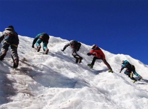
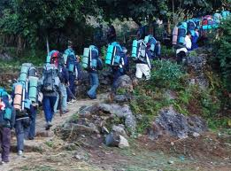
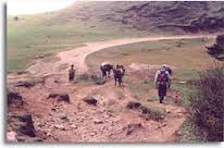
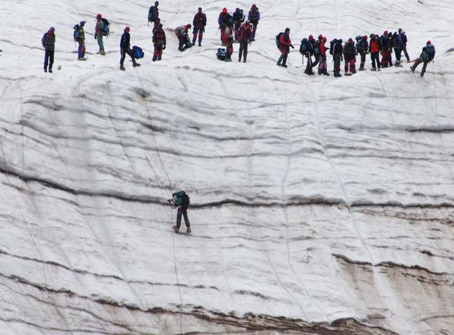
Trekking Darjeeling in India is said to be originated in Darjeeling, these date as far as eighty years ago, pioneered by Jesuit Rev.Fr Macdonald. Darjeeling has perhaps one of the most spectacular treks to offer, along the beauty of its magnificent hills. The ‘Singalila Trek’ as popularly known, enables one to discover the passion of the Himalayan region some of which is unmarked by humans. Darjeeling internationally acclaimed as one of the best hill resorts is also a veritable paradise for trekkers and adventure seekers. Trekking in Darjeeling is an experience which no lover of nature should miss. It takes one to places where nature is yet in her primeval majesty. It brings one face to face with the sublime grandeur of the Himalayas. The region abounds in rhododendrons, magnolias, primulas, orchids and ferns of numerous varieties. About six hundred different species of birds inhabit the emerald green forests on the slopes of the mountains. The following is a brief description of some of the most popular and most rewarding treks in the region.
Route No 1(a)
This trek is perhaps one of the best and certainly the most popular of all the treks in Darjeeling for those having a limited time at their disposal. It offers the travellers an excellent view of the Kanchenjunga and the Everest group of mountain peaks in Nepal, Sikkim and Bhutan.It is advisable to start the trek early in the day and to cover there distance from Darjeeling to Maneybhanjyang about 26 km. by jeep/buses. One can also go upto Sukhiapokhri, halfway from Darjeeling since transport to this point is easily available and from here to Maneybhanjyang either by jeep/buses or one can even trek from here to Maneybhanjyang (4 km). The drive from Darjeeling to Sukhiapokhri is about one hour and from there to Maneybhanjyang another half an hour.Maneybhanjyang to Tonglu is a steep climb up to Meghma 7 km or 3.5 hrs. walk. There is a small tea house where tea and snacks are available at reasonable price(if necessary, accommodation is also available at Meghma Tea House). Meghma is a small hamlet with few houses & small Monastery & impressive Chorten(stupa). Meghma to Tonglu is anothere 2 kms. Tonglu or the local name Tumling is 3070 mt. high and is one of peaks of Singalila range, falls on the West of Darjeeling town. On a clear day one can get a fine view of the Nepalese valleys and of the plains of North Bengal with the snow fed Teesta on the east, the Koshi on the West and a number of smaller rivers between them. There is a Trekkers Hut at Tonglu.
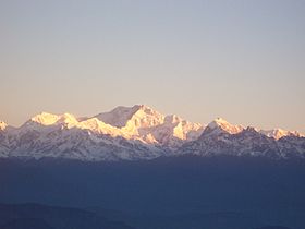
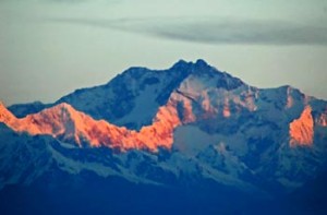
The next day’s march from Tonglu to Gairibas 2621 mt. is downhill. The distance is 9 km and it is 2 hrs. walk. The route passes through the bamboo glades. Gairibas to Kalipokhri 3170 mt. is continuous climb through the rhododendron forest. Distance is 6 km and it takes 3 hrs. walk from Gairibas. Trekkers may stop here for a while for a tea break. There is a small pond at Kalipokhri which means ‘Blackpond’. The colour of the water is black and muddy and it never freezes. From Kalipokhri the road descends to Bikhaybhanjyang-valley of poison-(Aconites grow in abundance at this place). Bikhaybhanjyang to Sandakphu is a steep climb of 4 kms. and takes more than an hour to cover this trek. Accomodation is also available at Bikhaybhanjyang and Gairibas. There is a trekkers hut at Gairibas.Sandakphu 3636 mtr. is 58 km. from Darjeeling and commands one of the most spectacular views. In the foreground is a great basin set in the midst of the hills, the slopes covered with rhododendrons and silver fir trees. In the background is continuous barrier of snowy mountains, the most prominent of which is Kanchenjunga-28156 ft. 8598 mts. towering up in gigantic height and breadth with its attendant peaks Kabru 7338 mts. 24,026 ft, Jano (Kumbhakarna) 7710 mts. 25,294 ft. and Pandim 6691 mts. 22,010 ft. clustering closely round it. Kabru is foreshortened and does not present the same graceful outline above the spectacle with its lofty peak standing up like a great icy horn. Far off to the west at a distance of 160 km. among a group of other snowy mountain rising from graceful peaks of Everest group can be seen,behind the crest of Mt. Makalu, which looks like a great armed chair of snow; and further to the west towards Nepal, there is a wonderful square mass of mountain looking like a wall of snow Chamlang 7317m-24006 ft. The contrast between Everest and Kanchenjunga is very marked. Kanchenjunga is remarkable for its imposing bulk and massive proportions while Everest soaring above a series of valleys and its ridges, is more graceful and majestic. The space between the two is occupied by snowy ranges. Three Sisters which cluster together if you look towards east beyond Kanchenjunga you will see Narsing and then the Dongkya and Chola ranges of the Tibetan frontier with Chumalhari lifting up to its heads in the rear. The whole snowy ranges of Bhutan, Sikkim and Nepal about 320 kms in length; is visible, but the panorama is completely dominated by the Kanchenjunga and Everest group.Kanchenjunga-correctly spelt is Khangchendzonga is the third highest mountain in the world means “”Five Treasures of the Great Snow”” and is a guardian deity of the Sikkimese.From the middle of April til 1st week of June this region blushes with rhododendron bloom and spread with carpet of lovely primula and other alpine flowers. Trekkers can stay at the Trekkers Hut in Sandakphu.The return march to Maneybhanjyang may be accomplished either in a day or two breaking journey either at Gairibas or Tonglu, depending on the physical condition of the Trekkers and the time at his disposal. If the first alternative is chosen, the journey must commence latest by 7 a.m. It takes about 8 hours of continous march to Maneybhanjyang.
Route No 1 (b) Upto Sandakphu is in route 1 (a)
If the trekkers have sufficient time next day they can march further towards Phalut 3600 mts. It is one of the loftiest peak in the Singalila Range is situated 80 km. North West of Darjeeling town. The name Phalut is a corruption of the Lepcha word Fak-Lut or the peeled summit and appellation derived from the bare treeless slopes, which offer a great contrast to the forest clad ranges below. The peak is also called Phalilung by the local people.The stretch from Sandakphu to Phalut is the most spectacular of the trek. The burned silver-fir forest makes most beautiful sight one will ever left come across. After walking for a little while the trekker will be followed by the Everest group on the left and Kanchenjunga range right ahead. A walk of about 4.5 hrs. from Sandakphu the trekker will come across a stone house with blown of roof on the top of a small ridge. The place is known as Sabarkum and is 14 km. from Sandakphu. An alternative place of stay is MOLLEY Trekkers Hut about 2 k.m. from Sabarkum, for those who do not want to walk to Phalut the same day. Keeping the ridge on the left follow the trail north ward. After about an hour the trail begins to climb through a series of zigzag till one reaches Trekkers’ Hut. From here Phalut summit is about 20 minutes walk.A magnificent view of snowy range is obtained from the summit which is also trijunction of Sikkim, West Bengal and Nepal. The general panorama is same as seen from Sandakphu except that KanchenJunga ranges looks much larger and closer. It is only 48 km. away as the crow flies. The trekkers will also notice on the foreground Singalila range jutting out of Kanchenjunga peak. There is a Trekkers Hut at Phalut. Trekkers can camp at Molley 1,811 mts. Phalut is 1.5 hours walk from this point Darjeeling-Maneybhanjyang-Gairibas-Sandakphu-Phalut-Rammam-Rimbick 130 km(6 days) upto Phalut as in route no 1(a). From Phalut to Rammam therw are two routes i) via Sabarkam ii) via Gorkhey-Samandin.
Route No 2(i)
To take in this route, retrace back to Sabarkum and turn left of ther roofless houses. This trail passes through the virgin forest which is steep down-hill to Rammam. This takes about 5 hrs. walk and 16 k.m. in distance. From Phalut, the right hand trail lead to Srikhola and climbs up to Daragaon and again descends to Rimbick. It takes about 8 hrs. walk and 25 k.m. in distance from Phalut.Note : Do not venture this trail during winter i.e. November and March as it gets dark by 4 p.m. and will be difficult to find the way.
Route No 2(ii)
From Phalut the trail descends the ridge through the virgin forests of chestnut, pines, hemlock etc. till the trail reaches the meeting of two streams called Gorkhey Khola which is a tributary of Rammam river. It ia a beautiful place. Trekkers can enjoy the bath in the river after the hectic trek begins to climb upto Samandian-a lovely plateau and it is a small forest village. From Samandin the road descends to a small stream and again climbs up for another 1.5 hrs. to Rammam Trekkers hut. This is about 5 hours walk or 15 km. in distance from Phalut.From Rammam the road is almost level walk for about first 9 km. and again it descends to Srikhola. The road rises steep, for about 1 k.m. where it levels out again till it reaches Rimbick. There is a small bazaar at Rimbick. Incase the Trekkers desire to return to Darjeeling by bus next day, it is advisable to stay at Rimbick bazar.Darjeeling-Rimbick-Sandakphu and back 123 kms. Four days.From Darjeeling to Rimbick regular buses are available around 12.30 p.m. It is about 5 hrs. drive and 54 km. from Darjeeling.
Route No 3(‘A’)
Darjeeling to Rimbick regular buses and jeeps are available around 7 and 12 noon-12.30 p.m. It is about 5 hrs. drive and 54 K.M. from Darjeeling. Next day’s march, is continuous climb through the forest of firs, chestnut, hemlock as well as rhododendron. During April, May the whole slops blazes with different colour of rhododendron. You will observe different types of birds in this area. The trail is continuous steep climb of 6 hrs. till you hit the main road to Sandakphu i.e. one kilometer ahead of Kalipokhari and then to Bikhaybhanjang to Sandakphu. Return trip can be accomplished via Gairibas, Maneybhanjyang or same route back to Rimbick and to Darjeeling.
Route No 3(‘B’)
Darjeeling-Tonglu or Gairibas-Sandakphu-Srikhola via Gurdum to Rimbick.Sandakphu-Gurdum is about 3.5 hrs. walk and Gurdum to Srikhola is about 1 hr. walk. At Gurdum, which is worth spending a day, there is a private accommodation and at Srikhola there is Trekkers Hut. Srikhola to Rimbick is 2 hrs. walk whereas Gurdum to Rimbick is about 4 hrs. walk.Darjeeling-Tiger Hill and back 26 k.m. one day trek.
There are two walking routes from the town.
(i) Tenzing Norgay Road starts from Chowrasta and passes through Toong-Soong and Aloo-Bari villages. The road is almost level and there is no vehicular traffic on this road. It meets the Hill Cart Road at Jorebungalow. From Jorebungalow the road ascended to Tiger-Hill is 5 km.
(ii) Gandhi Road starts from Planters Club Motor stand. This road goes almost parallel to Hill Cart Road and meets the Hill Cart Road near Ghoom Railway Station.
Both the routes offer the Travellers excellent view of forests and mountains.
TREKKING SEASON
There are basically two trekking seasons in Darjeeling. Generally the first one begins in the middle of March and closes around first week of June. One has to be prepared for an occasional shower, which is very refreshing. The flowers in bloom compensate the summer haze. The second season begins around last week of September and goes on till December. The view during this period is excellent but it is quite cold and one may expect snowfall in certain regions. ”
HistoryEdit
Trekking today is an integral part of Darjeeling Tourism – earning revenues from domestic as well as international trekkers.People have been transporting goods and ferrying people all over the Darjeeling Hills for centuries but, organized trekking for the purpose of recreation and sport was introduced in the early 1900s when the British began conducting organized trekking trails for their friends who visited from Britain. This craze of wanting to indulge in an adventure sport, which entailed an element of risk and unpredictability and exploring high altitude terrains caught on with the Indians.
Must SeeEdit
Must see
Visiting TimeEdit
During the day time
Closed OnEdit
N.A.
Best Season to VisitEdit
Winter (December to January)
Spring (February to March)
Summer (April to June)
Autumn (September to November)
Best Time To VisitEdit
Morning , Afternoon , Evening and Night
Time Required for SightseeingEdit
N.A.
Ticket Required : Yes Edit
Individual National Adult Rs. : Rs. 2,700/- to Rs. 3,000/- per day per person for Sandakphu trek that includes transport, accommodation, basic food, equipment and guide (this was last updated in October 2011 and subject to change).
Kids Rs. : N.A.
Individual Foreigner Adult Rs. : N.A.
Kids Rs. : N.A.
Still Photo Camera Rs. : N.A.
Video Camera Rs. : N.A.
Guide Required : Yes Edit
Approximate cost: Rs 300 per day
Dress Code (If Any) : No Edit
Dress Require: N.A.
Restaurants NearbyAdd / Edit
- N.A. ; N.A. ; Ph/M – N.A. ; Food Serve – N.A.
How to ReachEdit
Taxi : Intra-city transport is mostly by hired taxis. The private taxis or cars are essentially of two types – small cars like Maruti Vans or Santros, and large ones like Scorpio, Tata Sumo etc. While you can always take a private taxi/car from outside the station or airport, negotiate the rates and move for Darjeeling, it is always advisable to take one from the Pre-Paid taxi counters located inside the station and the airport.
Bus : “You will get buses only from the Tenzing Norgay Central Bus Terminus located on Hill Cart Road in Siliguri. It is about 8kms from NJP station. The usual route is by Hill Cart Road and the travel duration is about 4 hours. Bus fare from Siliguri to Darjeeling Via Hill Cart Road: Rs. 50.00 per person Bus fare from Siliguri to Darjeeling Via Mongpu: Rs. 80.00 per person. The Mongpu route is taken in case the Hill Cart Road is closed. After getting down at the bus stop, you can take an auto-rickshaw, or hire a taxi to reach the destination within the city.”
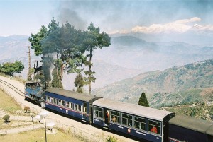
Train : New Jalpaiguri is the nearest major railway station. New Jalpaiguri is well connected to major Indian cities, especially Kolkata. The diesel engine hauled toy train leaves NJP station at 9am and takes about 7 hours 15 minutes to reach Darjeeling. You can also board the train from Siliguri Town Station or Siliguri Junction Station that are 5kms and 8kms away from NJP respectively. There are also toy trains available from Siliguri Junction and Darjeeling for joy rides. These are steam engine hauled toy trains. Check out Darjeeling Toy Train Services for current status and schedules.
NJP to Darjeeling (1st Class): Not operational since Sept 2010 due to track damage
NJP to Darjeeling (2nd Class): Not operational since Sept 2010 due to track damage
Darjeeling to Ghoom & back Joy Ride (First Class): Rs. 270.00 per person if booked through IRCTC website. This two hours ride includes entry fee for the DHR Museum at Ghoom.
Siliguri Junction Station to Tindharia & back Joy Ride: Rs. 496.00 per person. After getting down at the railway station, you can take an auto-rickshaw, bus or hire a taxi to reach the destination within the city.
Air : Darjeeling does not have an airstrip. The nearest airport is Bagdogra airport (IXB), near Siliguri, which is a 3-hour (approx. 90 km) drive from Darjeeling. Indian, Jet Airways and Kingfisher Airlines are the three major carriers that fly to Delhi, Kolkata and Guwahati from Bagdogra. Indian Airlines (2254230; Chowrasta) (10am-5.30pm Mon-Sat). Pineridge Travels (2253912; pineridge@mail.com; Nehru Rd; h10am-5pm Mon-Sat) For domestic and international flight tickets. After getting down at the airport, you can take an auto-rickshaw, bus or hire a taxi to reach the destination within the city.
Others : Toy train are also available for this destination.
Things to CarryEdit
carry light snacks, such as biscuits, nuts, raisins, chocolates etc and mineral water as there are some places where water and food are not available and to carry clothes suitable for low tropical area to high mountain ranges like light woollen cloths i.e. sweater , Tee-shirts, shorts or comfortable pants to heavy pull-over, wind cheater, woollen cap, gloves etc. A raincoat is a must as the weather in the higher altitudes is difficult to predict. Medicines to carry when you are travelling to a new place or when you’re away from home town
Safety / WarningEdit
Drinking Water Problem in Darjeeling.
HelplineEdit
Police-100
Women-181
Fire – 101
Ambulance – 102
Child Helpline – 1098
